


Earth Observation Mission Control Center
EOMC2 (polish: COMOZ) project was designed to create Operations Centre supporting aerial missions carried out in the Remote Sensing Department and in the future satellite missions. The Centre’s task is to monitor air missions (including realized within the project HESOFF) and receive data from various satellites (observation, research, etc.). With the center, we can track the flight path of the airplane and have a preview of acquired images and data from satellites in real time. The acquired data are processed on the photogrammetric station and numerical laboratory. As a part of EOMC2, there is also the station of obtaining the spectral signatures. All these areas are interlinked and form an extensive monitoring and processing system. In the project is also used radio communication providing transmission of telemetry data from study areas to our Centre. The acquired data are stored on the GIS server and Data Warehouse.
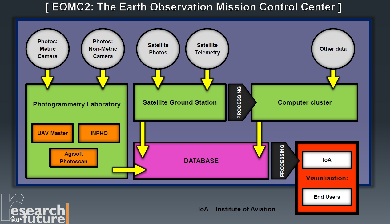
Photogrammetry Laboratory
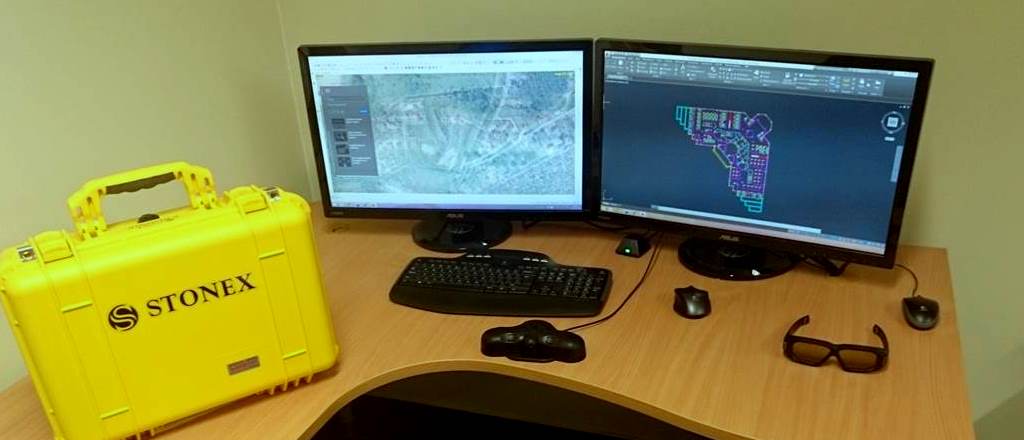
Photogrammetric Station allows processing images acquired in the mission with the use of manned and unmanned aircraft. Installed software allows assembles a mosaic of images, generating orotfotomap, creating a three-dimensional terrain model. During processing are used the programs like: Agisoft, UAV Master and Inpho package. For less professional studies we use mosaic programs: PTGui and free ICE. On equipped laboratory is also RTK GPS receiver for accurate field measurements and determination of ground control points.
Satellite Ground Station
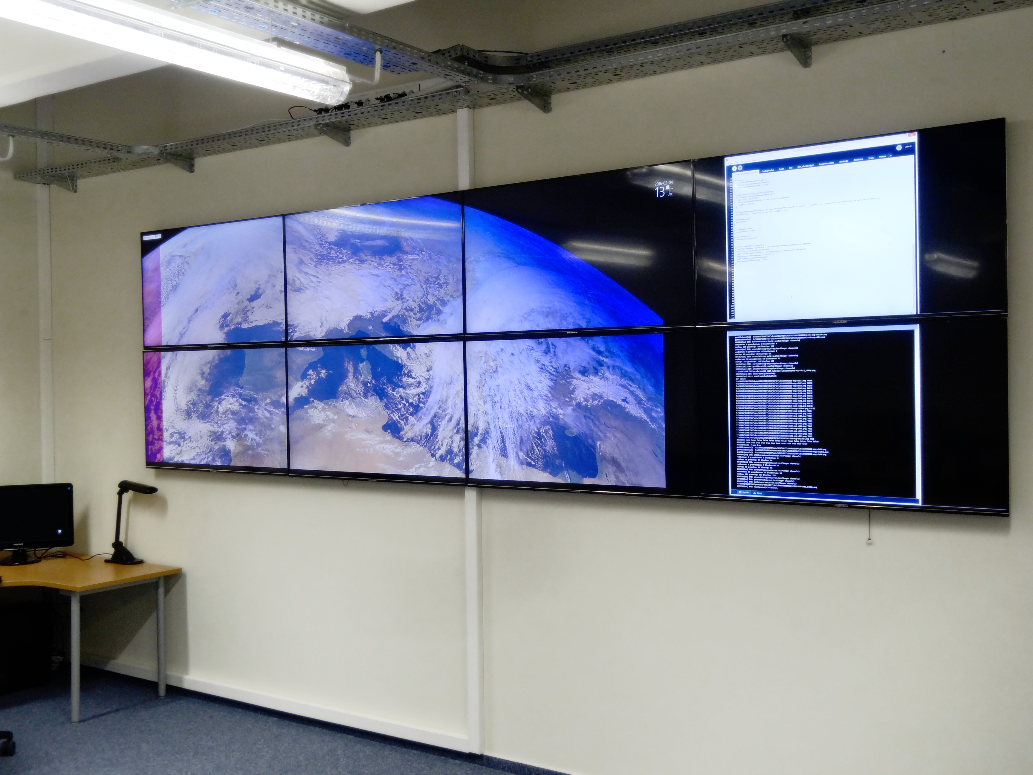
Created within the framework of the EOMC2 project station allows the acquisition of data from meteorological satellite systems for each flight mission and telemetry data from small scientific satellites. The station also provides access to the satellite multispectral images (satellites like Landsat, SlobeSnow, etc.). Created in EOMC2 software allows to observe satellite trajectory and receive its signals. The Division is equipped with a large, offset satellite antenna with a diameter of 1.8m that allows obtaining data from the network EUMETCast and with a set of directional Yaga antennas to receive telemetry from scientific satellites. Acquired satellite data and images, and mission parameters are displayed on six screens installed in the EOMC2 room. Data visualization on the monitors takes place on the map base. It is possible listing the telemetry data and visualization of remote sensing indicators. The parameters of the platform/camera are presented with the possibility of autoconfiguration.

Remote Sensing Division has its own server for gathering all the data obtained from aerial missions, scenes and satellite data. The cluster provides numerical analyzes suitable for selected remote sensing algorithms, archiving and sharing the resulting data with the flights, including aerial photographs, mosaics, orthophotos and satellite data. Utilizing the high computing power it is possible to analyze the advanced image, that allows creating large map’s elaboration. On a publicly accessible web server are stored types of GIS layers (raster, terrain model, altitude model) generated based on acquired images. The cluster operates independently from the other components of the Operations Centre, that is why it is possible to use its resources to other variety of research, not only related to the analysis of aerial and satellite imagery. Cluster dramatically increases the processing efficiency of acquired data.
M.Sc. Eng. Mariusz Kacprzak
phone: +48 22 846 00 11 (896)
fax: +48 22 846 44 32
mariusz.kacprzak@ilot.lukasiewicz.gov.pl